


Palaeo-landscapes
TigerGeo undertake palaeo-environmental investigations as elements of environmental management and heritage projects. Surveys tend to examine the upper 6-10m of ground, with an emphasis on variation of the superficial deposits resulting sometimes from hydrological action (e.g. fluvial structures), peat formation in upland areas or past sea level rise around major estuaries. A variety of geophysical systems, combined with processing of terrestial or airborne LiDAR data, can allow a detailed model to be developed, ideally supplemented by borehole or testpit data.
Methods
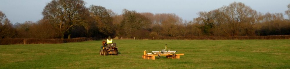
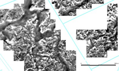
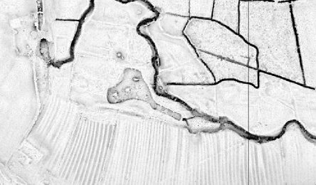
With rates of total magnetic intensity coverage reaching 15 ha / day per array it can provide a rapid overview of large sites where appropriate geological conditions exist and especially in former tidal areas or over former marine deposits. Although the result is planar it is ideal for determining optimum locations for boreholes and testpits or for planning more targeted areas of geophysical investigation using other methods to develop a 3D model, including electrical resistivity tomography (ERT) or electromagnetic induction (EMI).
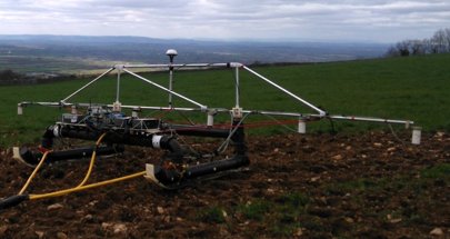
EMI survey can also be undertaken using ATV-towed systems, sometimes simultaneously with magnetic survey if circumstances require this. The two methods are complementary and the data is responsive to different environmental parameters, with EMI also being suitable in low magnetic susceptibility environments, e.g. away from former marine deposits.
Data and results
Our unique strength is being able to utilise archaeological expertise to relate palaeo-environmental data to landscape features. Interactions between natural evidents like fluvial activity and prehistoric land boundaries can provide a terminus post quem for natural events. The effect of more modern activities like land drainage and cultivation upon the palaeo-environment can also be assessed.
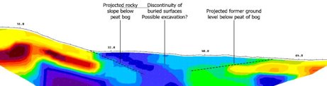
The use of LiDAR data in combination with geophysical data allows 3D models to built and navigated and again the influence of agriculture both ancient and modern upon palaeo-environmental contexts to be examined.
Smaller scale detailed work can be undertaken, using electrical techniques for example, to examine specific contexts, e.g. the depth of filled channel structures or the thickness of peat over bedrock. In the same way that archaeological data can supplement palaeo-environmental investigation, detailed work of this nature can significantly boost understanding of past human activity and the nature of buried deposits of archaeological interest.


©TigerGeo Limited - Registered in England & Wales 09895326 - D-U-N-S 22-127-7456 - All Rights Reserved